|
 |
|
page: 1 | 2 | 3 | 4 | 5 | 6 | 7 | 8 | 9
|
|
|
Early next morning I leave for the volcano Zaquete (5.314 m) which has fantastic views of the El Tatio geyser field and the other volcanos around here. In the distance is the Pacific Ocean. It takes me four hours to get to the top and about one to get back to the camp. My headache is getting worse and my stomach feels strange. Maybe I gained altitude too fast.
|
|
 |
|
|
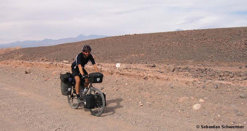
On the way to San Pedro de Atacama
|
|
|
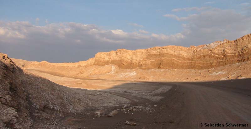
One day later I cycle back south over the 4.500 m high pass and cross a large high plain with several small passes and cold rivers. I don´t want to take any risks and take off my shoes and walk through the cold water. Even during the day temperatures here don´t rise above 8°C. After an extended lunch break comes the long downhill to San Pedro de Atacama which is at 2.200 m. But the dirt road is very soft and the corners are covered with loose and blocky gravel. My rims get so hot from braking I have to take a 10 minute break to cool them down. At the last river crossing I meet an elderly Chilean couple that immigrated from Germany 40 years ago. They invite me for lunch below shady trees.
|
|
|
|
|
|
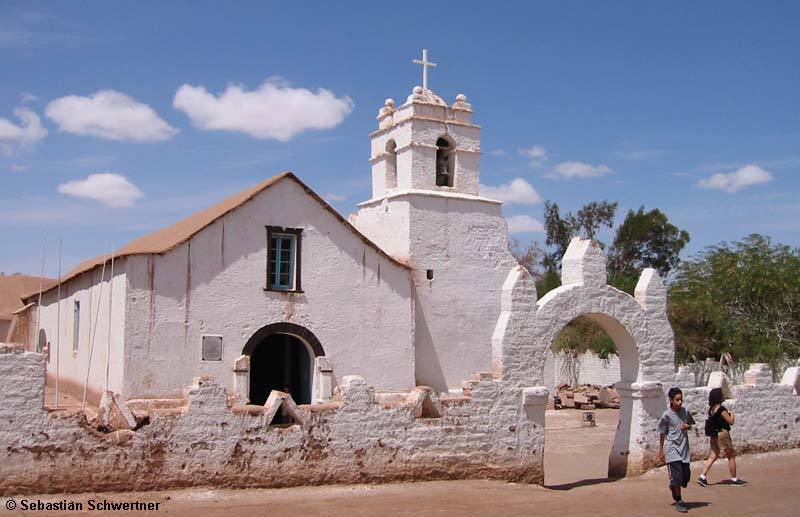
Church in San Pedro de Atacama
|
|
|
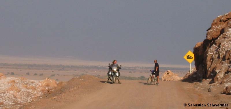
San Pedro de Atacama is a small oasis that lives off tourism. But it´s much quieter here than in Pucon. There aren´t any pubs open all night long. I pitch my tent on a small campground below shady trees and walk through town. On the Placa des Armas I´m surprised to meet Thomas again. He was following my tracks on the Ruta 1 between Taltal and Antofagasta.
|
|
 |
|
|
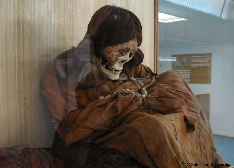
Mummy
|
|
|
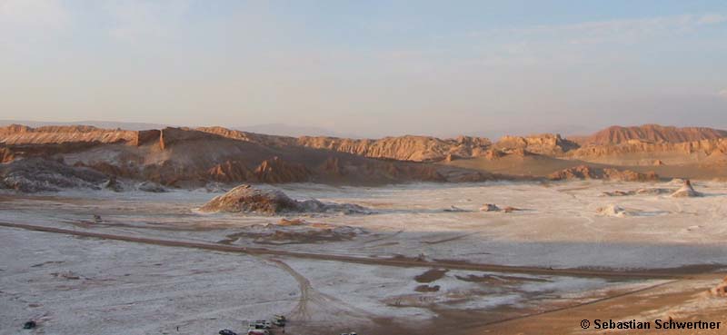
The following day we visit the good historical museum and pedal in the evening with Julia to the Valle de la Luna. This is a colorful valley in the desert especially in the last light of the day. We get back in total darkness and go out for dinner with other travellers. It´s good to be among friends again.
|
|
 |
|
|
Meeting on the road
|
|
 |
|
|
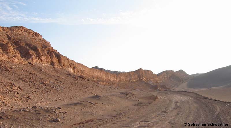
Valle de la Luna
|
|
 |
|
|
Valle de la Luna
|
|
 |
|
|
Salt crusts
|
|
|
Two rest days are enough for me. So I pedal up to the pass Paso de Jama to climb the volcano Tocol (5.565 m). From San Pedro the road is flat to the border post to Bolivia and Argentina. But then climbs from 2.200 to 4.700 m in one long 35 km climb. The road is freshly paved but the grade is up to 17%. In the evening I set up my tent in a dry valley one km from the road. Up here it gets cold at night. My water bag is frozen solid in the morning.
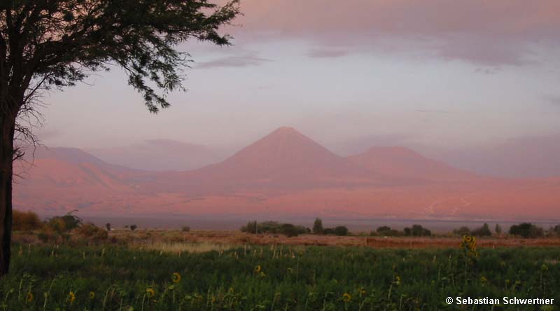
From the tent I hike for three hours to the summit and see Bolivia and the Salar de Atacama below me. The perfect cone of the volcano Liancabur (5.915 m) seems just across the road. Now that is a summit I really want to climb. Back at the tent I sleep for two hours and then pedal back to the border station in 40 minutes. The same distance took me six long hours the day before.
|
|
 |
|
|
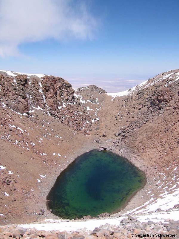
Volcano Licancabur
|
|
|
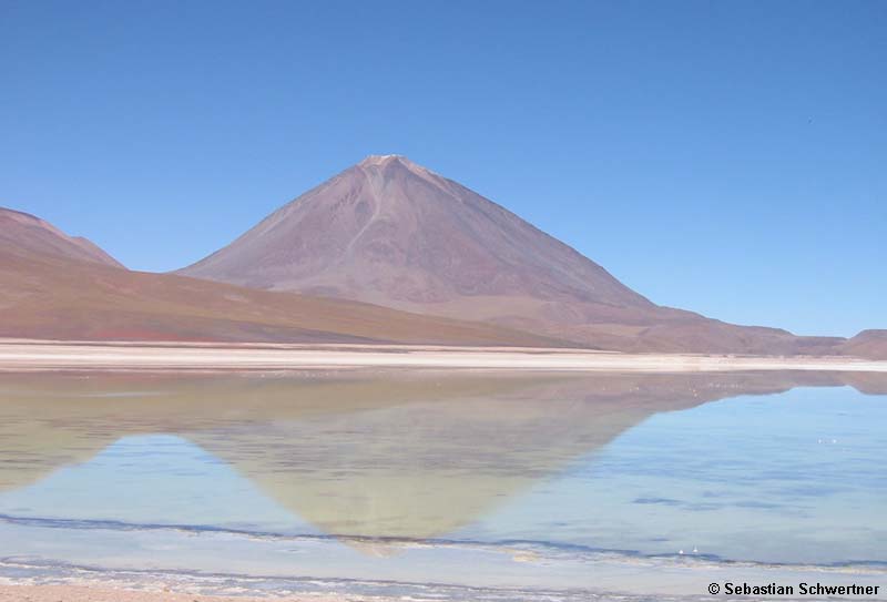
After another rest day in San Pedro I take the Colque bus to the Laguna Verde in Bolivia. Which is only 50 km away. I spend the night in a simple hut at the lake. Early next morning I get a lift to the base of Licancabur. A young Bolivian climbs with me to the summit. We get there around noon. The landscape is so dry there is hardly any snow here at 6.000 m and the deep green crater lake is not frozen.
|
|
 |
|
|
Laguna Verde and Licancabur
|
|
 |
|
|
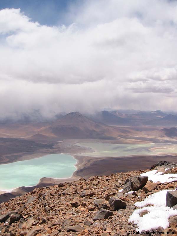
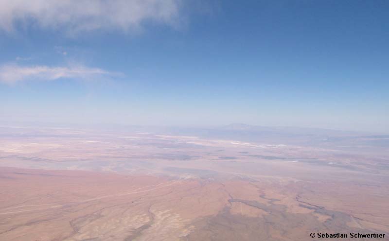
View from the summit of Licancabur with the Salar de Atacama in the background, on the left is the road to Paso Jama, on the right dark and younger lava flows
|
|
|
|
|
|
|
|
|
|
|
|
|
|
|
page: 1 | 2 | 3 | 4 | 5 | 6 | 7 | 8 | 9
|
|